To subscribe to the email, please send a blank email to: raildate+subscribe@groups.io
Raildate is a collaboration between the editor and a number of contributors. Please think about supplying links that you spot. The contact email address is: raildate.co.uk@gmail.com
There are sections on:
East
East Midlands
London
Midlands
North East
North West
Scotland
South
South East
West
National
Argentina
Czechia
Europe
Italy
Japan
Mexico
Switzerland
Turkey
Air
Bus
Marine
Thank you to this week's contributors.
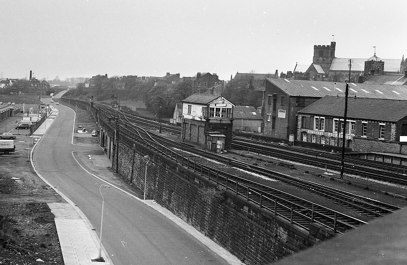
This area was transformed just before a 1970s picture was taken. And it has been transformed again since. Where is it?
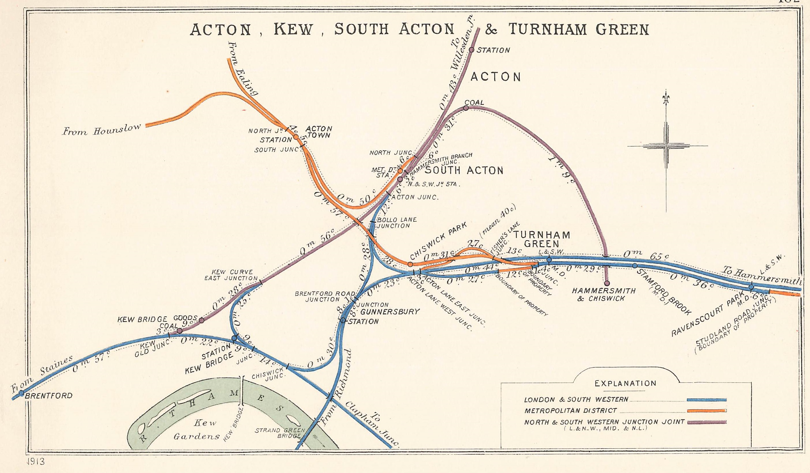
A Railway Clearing House diagram from 1913. Where is it?
Answer: Acton, Gunnersbury. Congratulations are due to the following for their correct answers: Colin Penfold, Dave Goodyear, Phil Deaves, Jim Allwood, Tom Burnham, Chris Neale, Jeremy Harrison, Chris Gibbard, John Musselwhite, John Lacy, Jane Sullivan, Bryn Pitcher, Paul Hopper.
The branch to Hammersmith & Chiswick closed soon after (1917). It had been a rural branch when opened in 1858, with through carriages from London Broad Street uncoupled at South Acton. Three request stops (Rugby Road Halt, Woodstock Road Halt, and Bath Road Halt) existed but are not shown. There was a good connection with the tramway on Chiswick High Road but the branch couldn't compete when the L&SWR line opened through Turnham Green in 1869. That's when urbanisation took off.
At the time of this map, the Central London Railway (now the Central Line) planned an extension from its Shepherd's Bush terminus to Gunnersbury. WW1 interverned and the post-war extension turned north-west instead, towards West Ruislip.
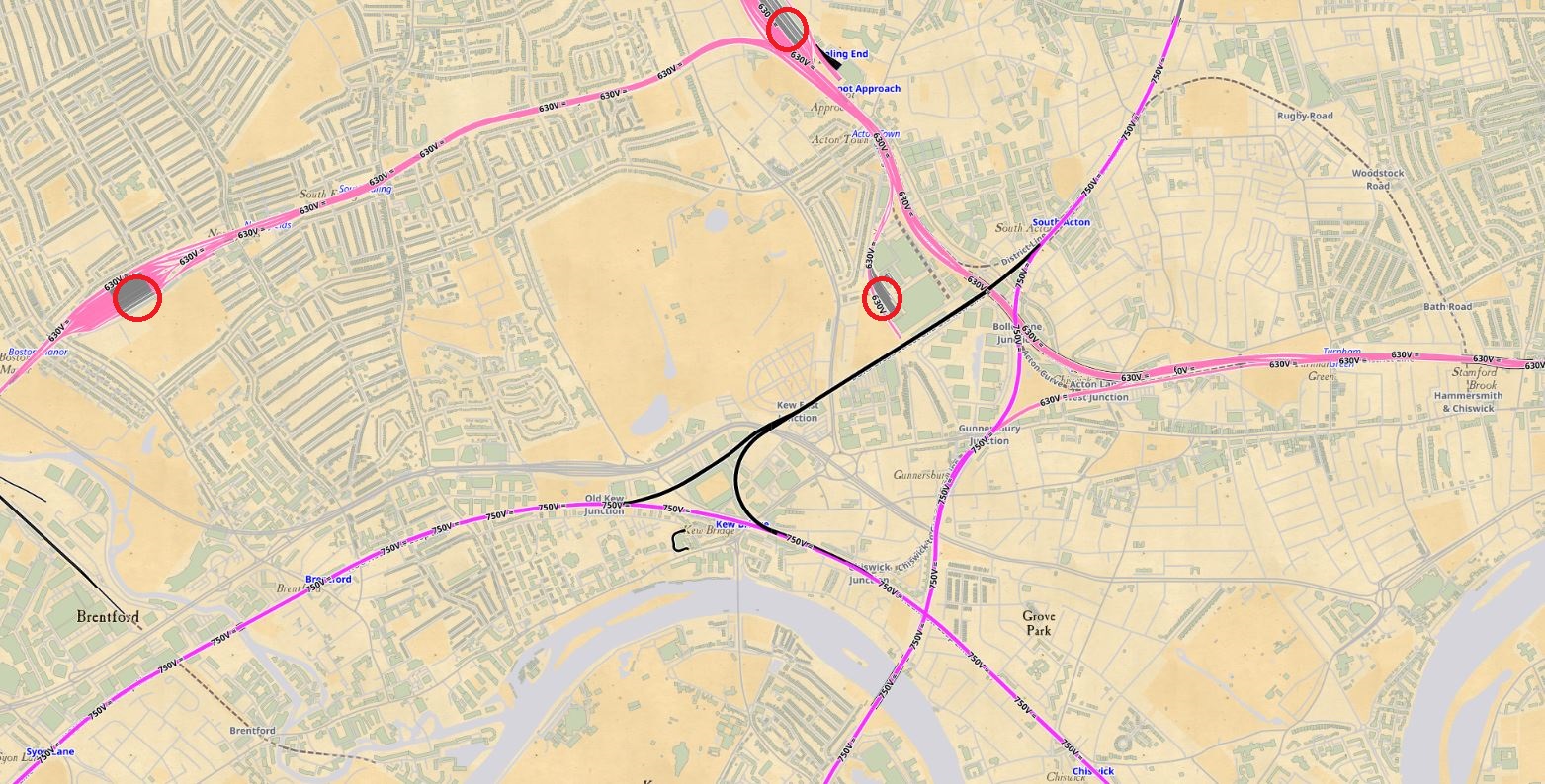
Many reorganisations later, the network is - minus the one branch - largely intact. De-duplication led to the L&SWR's Chiswick and Acton curves (north and south of Gunnersbury) being closed. Using data from Open Railway Map, we can see that electrical voltages differ between 750V on Overground/national lines and 630V on the District and Piccadilly lines. Train depots at Northfields, Ealing Common, and Acton are ringed.
The GWR's Brentford Dock branch did exist in 1913 but was excluded from the RCH map.
We welcome links to publicly available online news items and videos from anywhere in the world. Despite its name, Raildate covers all transport modes, including also bus, tram, air, and marine.
Raildate may be freely distributed without permission as long as no changes whatsoever are made to the original document distributed by the Editor.
The main Raildate website https://raildate.co.uk includes a history of Raildate by the founding editor Howard Sprenger and archived editions from 1996 to the present.
Facebook members are encouraged to join the Raildate group.
© Matthew Shaw 2024