To subscribe to the email, please send a blank email to: raildate+subscribe@groups.io
Raildate is a collaboration between the editor and a number of contributors. Please think about supplying links that you spot. The contact email address is: raildate.co.uk@gmail.com
There are sections on:
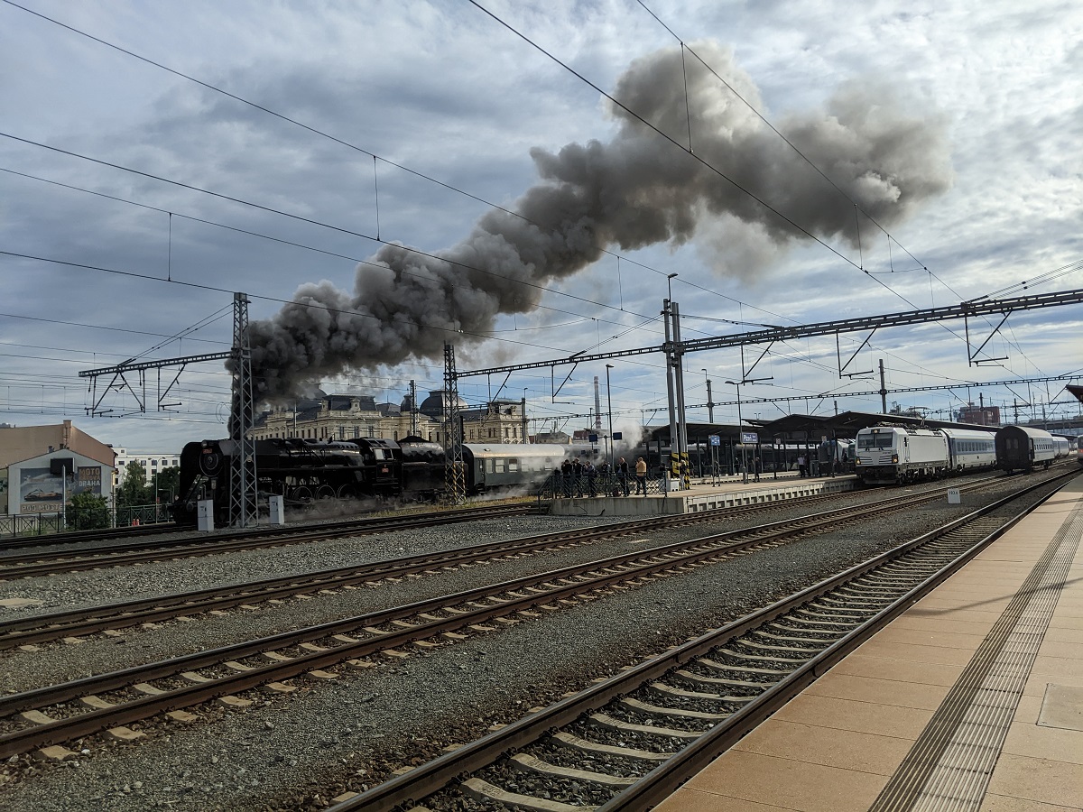
Your Editor has returned from Czechia but I thought you'd enjoy this image. It is CSD 4-8-2 No. 475.111, built in 1947 by Skoda, departing Plzen on 2024.06.15 at 08:00, beginning a weekend of touring. It is owned by the Iron Monument Club. Siemens Vectron 193 982 is waiting to depart for Cheb at 08:05. You can just see the end of a Pendolino on the near platform which luckily moved off for Prague (also at 08:00) in time to be out of the way for the steam departure.
East Midlands
London
Midlands
North West
Northern Ireland
Scotland
South
South East
Wales
Yorkshire
National
Europe
France
Germany
India
Japan
Malaysia
New Zealand
South Korea
Switzerland
Air
Bus
Marine
Thank you to this week's contributors.
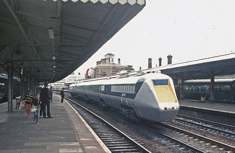
The APT-E is on a test run. Where is it?
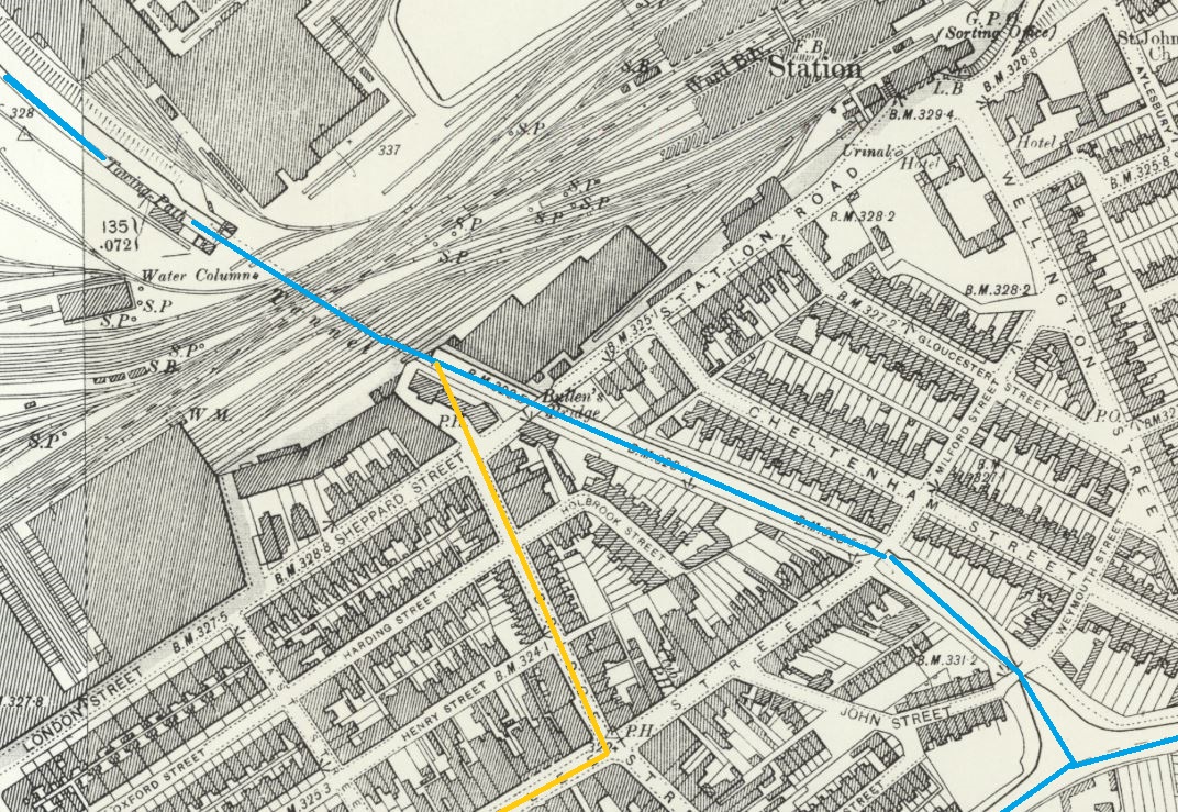
An important railway station and a canal junction in this map from c.1900. Where is it? [Send your answers to raildate.co.uk@gmail.com]
Answer: Swindon. Congratulations are due to the following for their correct answers: Colin Penfold, John Lacy, Tony Fox, Phil Deaves, Andy Foster. Neil Spencer, Paul Hopper, Simon Wass
The canal heritage of Swindon is a rather forgotten story. The map shows how the Great Western Railway accommodated in tunnel an earlier branch of the Wilts & Berks canal, which was heading NW towards the Thames & Severn canal at Cricklade.
The original canal is marked in blue but very little remains visible in greater Swindon. The canal effectively closed as long ago as 1901 after a major breach, so its poor preservation is unsurprising. The main line and junction are now buried under The Parade, Swindon's shopping centre ("Canal Walk").
There is a (wildly?) ambitious plan to bring the Wilts & Berks back to life. It was a long canal that connected the Kennet & Avon at Melksham with the River Thames at Abingdon. There were branches to Chippenham, Calne, and Cricklade. The yellow line is the proposed conversion of Fleet Street and Bridge Street into an Amsterdam-style canal, to make the Cricklade branch feasible.
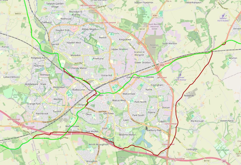
Reinstating the main line involves bypassing the entire town to the south, adjacent to the M4. The green line on the map below is the original line; the red line the new proposals. Map credit: Canal Map Online
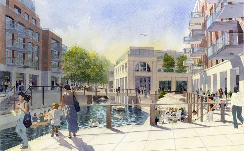
Bringing waterways in to regenerate towns is a popular theme. Much of the investment in my own town (above) is based around a formerly silted-up drainage channel. The buildings shown in this artist's impression were recently completed, and most of the commercial units are now let. Image credit: Solve Planning
We welcome links to publicly available online news items and videos from anywhere in the world. Despite its name, Raildate covers all transport modes, including also bus, tram, air, and marine.
Raildate may be freely distributed without permission as long as no changes whatsoever are made to the original document distributed by the Editor.
The main Raildate website https://raildate.co.uk includes a history of Raildate by the founding editor Howard Sprenger and archived editions from 1996 to the present.
Facebook members are encouraged to join the Raildate group.
© Matthew Shaw 2024